Technische Universität Wien
Orientation and Processing of Airborne Laser Scanning data
Department of Geodesy and Geoinformation - Research Groups Photogrammetry and Remote Sensing
Exports vector data stored in an OPALS data manager (ODM) in various data formats.
This manual starts with a short description of the OPALS Data Manager and data formats that are available for export. Furthermore, the parameters to control data export are explained including the filtering features (echo filter, geometric filters ...). Finally, some illustrative examples for the usage of Module Export are given.
OPALS uses the OPALS Data Manager (ODM) for the administration of ALS point clouds, as well as line related geometries (eg. breaklines, formlines, borderlines). OPALS modules dealing with primary topographic data use data manager files (*.odm) for input (e.g. Module Grid, Module Cell, etc.) and output (e.g. Module EchoRatio, Module Normals, etc.).
The ODM can be seen as a database system supporting efficient spatial queries, but also the storage of arbitrary attributes (referred to as additional info in OPALS) for each geometry object. These additional infos are added during import or by different OPALS modules (e.g. Module Normals which estimates surface normals in each point). Depending on the selected data format the geometry objects including the corresponding attribute columns are exported.
Module Export supports the following export formats and export strategies, respectively:
| Format | Description |
|---|---|
| original | Restore the original file(s) in the imported data format (not yet implemented) |
| wnp, bwnp | Winput and binary Winput files |
| xyz, bxyz | xyz and binary xyz files |
| las | LAS |
| sdw | Riegl SDW (Sample Data World) files |
| fwf | IPF internal full waveform text format (currently only FWF 1.0 can be exported) |
| shape | Shapefiles |
| <opals format definition xml file> | Generic export of text and binary file |
The examples shown in this section rely on the full waveform ALS data set fullwave.fwf located in the $OPALS_ROOT/demo/ directory and can be imported into the ODM by the following command:
To export the point cloud in a simple text XYZ format, type:
The resulting text file contains the 3D-coordinates only and starts with the following lines:
However, the imported file contains additional attributes from full waveform data processing (GPS time, amplitude, echo width, ...) which is well preserved in the respective ODM file. To maintain this information, data formats capable of storing full waveform information like Riegl SDW should be used. The following example also illustrates how filters can be used to export a limited set of data from the ODM (i.e. all last echoes in this case):
To demonstrate further possibilities offered by Module Export, a few more preparation steps are carried out. First, the surface normals are calculated and, subsequently, the echo ratio is determined for each point.
After executing the above commands the ODM file additionally contains information about the surface normals (additional info: NormalX, NormalY, NormalZ, NormalSigma0, NormalEigenValue1, ...) and the echo ratio (additional info: EchoRatio).
Module Export also supports the ASPRS LAS file format, which is widespread in ALS data processing. While any version of the LAS file format standard allows a user-defined number of bytes to be appended to each point record, only LAS 1.4 has introduced means to document these Extra Bytes. OPALS supports the import (see Module Import) and export of ODM attributes from/to LAS 1.4 files by usage of a LAS Format Definition . To export the attributes calculated above, type
at the command prompt, using the OPALS Format Definition mentioned here. In general, it is also possible to provide the format definition as inline XML string to the oFormat parameter (also see OFD as Parameter). In case of exporting attributes a xml-file might be more preferable but for simple situation where only the LAS version (and point data record format) is relevant the string option is well suitable. As shown below, abbreviation are allowed in the same manner as for module parameter in the command line (all commands produce the same output file).
For completeness, an example of exporting the attribute NormalSigma0 as extra bytes using an inline XML string is also given:
The extra attributes per point can also be output in a user-defined text or binary OPALS Generic Format, which is supplied to Module Export as the path to an OPALS Format Definition file, e.g.
The above format definition is an example for storing normal vector (NormalX, NormalY, NormalZ) and echo ratio (EchoRatio) information together with the point coordinates (x,y,z). It is provided as normalsEchoRatioAscii.xml in the directory $OPALS_ROOT/addons/formatdef of the OPALS distribution. Executing the command ...
... will produce a file starting with:
As OFD files are searched for in the current working directory as well as in the $OPALS_ROOT/addons/formatdef directory, the above command can be written in a more compact way omitting the full OFD file path:
The resulting file contains a file header consisting of 2 lines, as indicated by the respective header section of the format definition file. Furthermore, if an attribute to be exported is not available for a certain point, a default value is output, which is zero or an empty string, depending on the attribute type. This default value is overruled by specification of the XML-attribute invalidValue of element entry. Note that in the example shown above all point attributes are valid, however.
opalsExport is an efficient tool to cut out rectangular regions from a large list of ODM files using the limit parameter. First the bounding of the ODMs are intersected with the given limit windows. Only in case of intersection the corresponding ODM is opened and a subsequent spatial query on the actual data is performed. Hence, the processing time depends on the amount of data that is covered by the given limit but it's (nearly) independent of number of files that are provided. Note that wildcard characters (*,?) can be used for defining multiple ODM files at once:
ESRI Shape files can be utilised for data exchange
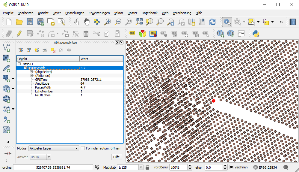
transporting geometry objects including their attributes. Using OFD Shape files specific attributes can be exported into the corresponding dbf file. In the following example single points including there fullwave attributes are exported based on the OFD fwfShape.xml which can be found in $OPALS_ROOT/addons/formatdef/
The resulting shape file can be loaded into e.g. QGIS to query/visualize the fullwave attributes of the points.
 1.8.17